

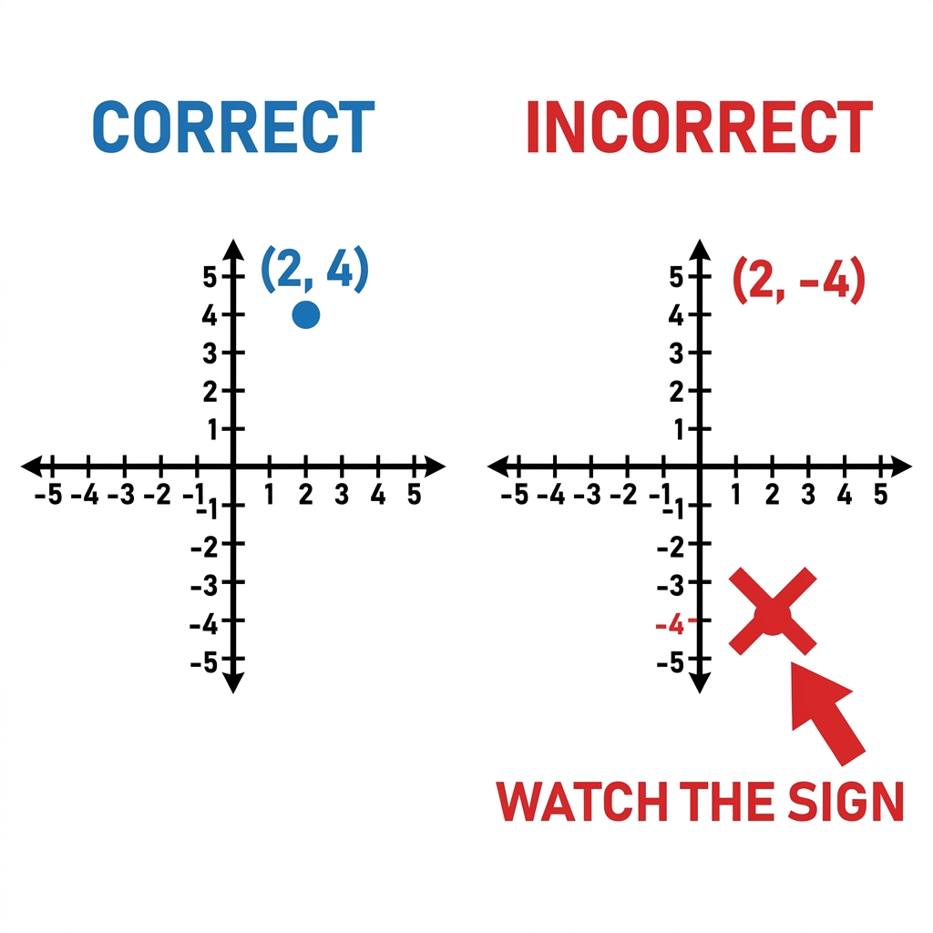
When we hit the middle of the school year in 6th grade mathematics, the shift from positive values to the full set of rational numbers often trips up the students who felt confident back in the fall. We move from the simple number line they used in elementary grades into the four-quadrant coordinate plane, and the jump is not as intuitive as we might hope. This is why I find the Exploring Rational Numbers on Lines and Planes lesson so useful for getting the class back on track. It is a solid, focused piece of curriculum that assumes students know their basic number lines and pushes them to see how negative values occupy specific, logical spaces.
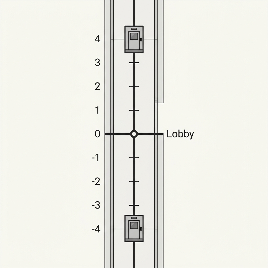
This lesson is a great fit for a whole-class assignment, but I often pull it for a student who missed the week or needs a quick intervention session to sharpen their grip on the number system. It starts by acknowledging what students already know: that a standard horizontal number line is just the beginning. The material introduces a vertical number line, comparing it to a thermometer to help students visualize values that sit above and below zero. This mental model is vital because it makes the concept of a rational number, which the lesson defines as any number that can be expressed as a fraction including whole numbers, negative numbers, and decimals, feel less abstract.
Building the coordinate plane from the ground up
The core of this work is about moving beyond the line and into the two-dimensional grid. Students work through plotting rational numbers on a coordinate plane by learning how to use the x and y axes. I appreciate that the lesson uses a city planner scenario, which takes the dry math and puts it into a context that makes sense for a 12-year-old. When a student is mapping out park locations, they are forced to engage with the terminology. They learn that a coordinate plane is a flat surface formed by two number lines crossing at a right angle and that each of the four sections created is called a quadrant.
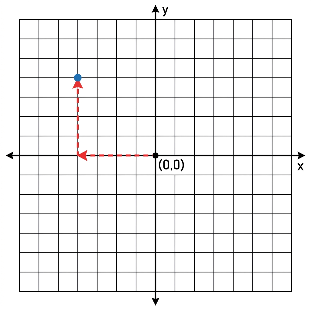
The worked example is straightforward and hits the right level of detail. To plot a point, students start at the origin where the axes cross. From there, they move along the x-axis and then the y-axis to reach their destination. It is a procedural skill, yes, but when you watch a student struggle to identify which direction to move for a negative value, you realize this is the foundation for almost every algebraic concept they will see in high school. If this foundation is shaky, you will see them struggle with slopes and linear equations for years to come.
Aligning with state standards
This lesson is built to address CA.MATH.6.NS.6. This California-adopted standard asks students to understand a rational number as a point on the number line and to extend those diagrams into the coordinate plane to represent points using negative coordinates. The lesson also incorporates CCSS.MATH.6.NS.C.6, which acts as a companion standard that reinforces the extension of coordinate axes. It is the same requirement taught across the state in districts like Fremont Unified, San Juan Unified, Victor Valley Union High School District, and Santa Rosa High School District. By focusing on both horizontal and vertical lines, the lesson ensures students can handle the grid regardless of how a problem is oriented.
One limitation here is that some students might find the jump to negative fractions difficult. If you have a class that is already struggling with mixed numbers, you might need to pull a few extra physical manipulatives before they jump into the digital grid. The vocabulary terms are essential, but the real work happens when they start clicking through the coordinates. I have found that spending 45 minutes on this helps clear up those persistent misconceptions about the signs of coordinates, especially in the second and third quadrants.
Where students slip on the coordinate plane
The most common error I see is students reversing the order of the x and y coordinates. They want to move up or down before they move left or right, or they forget the origin is the starting point entirely. The lesson uses the GPS navigation analogy to explain why this order matters, which is a rare moment where the real-world application actually helps the students remember the procedure. GPS navigation relies on these specific coordinate principles to guide vehicles, and it is a good way to frame the conversation when a student asks why they cannot just plot numbers in whatever order they please.
If you have a student who is doing independent study or finishing attendance recovery, this is a clean, reliable way to make sure they have the technical proficiency needed for the rest of the unit. It is not an overly long lesson, which is perfect for maintaining focus, and it does not try to teach too much at once. It sticks to the number system, focuses on the axes, and builds confidence before moving on to distance or area calculations. It is a tool that works exactly as described, helping teachers ensure that every student knows their place on the grid.
Related lessons
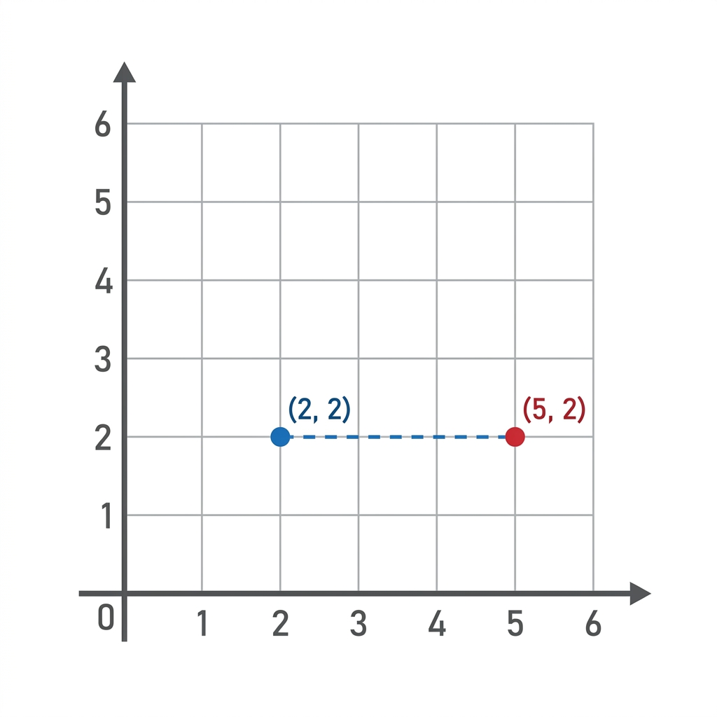
Mapping Points and Distances on a Coordinate Plane, Calculates distances between points using coordinate plane axes
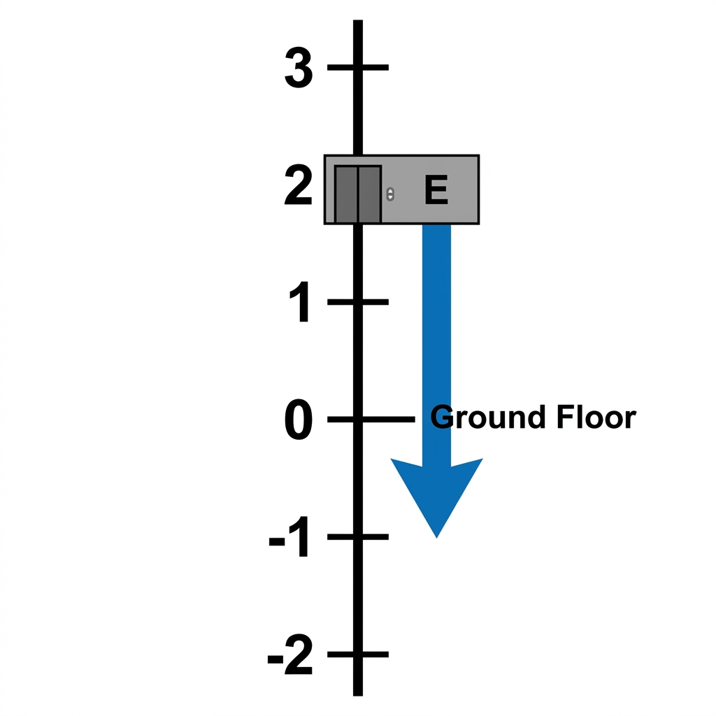
Understanding Rational Numbers on Lines and Grids, Visualizes rational number placement on various grid structures
Understanding Rational Numbers and Opposites, Explains concepts of negative numbers and mathematical opposites